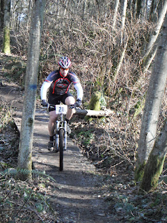
Our ride up to Suntop Trail
Nearby Town: Enumclaw, Washington
Ride type: loop
trail type: single track 75%
fire/gravel road 25%
Distance: 18 miles
Elevation gain: 4000 feet
Climbing: long
skill level: Advanced skills
Trail Description:
If you like spectacular scenery and amazing views, then this is the ride for you. It starts with a grueling 7 mile 4,000 foot climb, but rewards you with the most breathtaking view of Mt. Rainier you won't soon forget. At the top, take in the sights and an energy bar and get ready for miles of amazing singletrack. The beginning of the decent is steep and technical, but the challenges ease as the trail descends.
 |
See the zigzag marks in the trees on the mountain beyond Lan?
Thats the 5 miles of gravel road we rode up. And up and up and up.
There were no breaks in the UP on this gravel road, not even
a dip.
Lan sure has sexy legs in this photo. |
How to get there:
From Enumclaw, drive East on Highway 410. After about 30 miles, keep your eyes out for road #73 on the right. (if you see the Visitor's Information Center, you have gone too far. But since you're there, you might want to pick up a map of the trail). After turning onto road #73, cross the bridge and immediately turn right into the small parking area. If you have two cars, you can drive a second car to the top of Sun Top Mountain and then ride back down to your first car.
Lan and I went up near Mt Rainier on August 27th, 2010 to ride this trail. Lan had been there before so he kinda knew what we were in for but he must have had a fuzzy memory. We thought we had plenty of time for this ride but later I'll tell you about our timing.
After we got up the 5 miles of gravel roads we got to this point, not the beginning of the trail but the part where Lan said I would be able to do it. I guess the top is way technical and steep and I wouldn't be able to do it. We thought we were home free at this point, all ready to go down now...
Going down wasn't an option there though; we had to climb up the single track trail for another mile! We passed a few guys at this view point, they took our photo and that was nice of them.
Side note: a couple days later Lan and I went to Tiger Mtn Summit and those same guys were there.
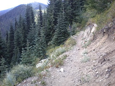
The trail was steep on the sides, it was just like this photo and I really did ride along the trail but I was so careful not to look over the edge. I always steer where I'm looking and I didn't want to go over the edge.
Another point a ways farther up the road. It was getting chilly here.
I love these kinds of trails. They challenge me to the extreme but as I do more and more of them I am learning new tricks and skills. In the video below you see one of the guys who we passed on the trail. He was the last one to pass us and he was slow, I was actually faster than he was but only by a split second. The other guys BLASTED past us on this section of trail and it took me too long to get the camera out to get video of them.
Lan and I finally got to ride down for about a mile or so when we realized we were running out of daylight. It was getting quite chilly even with our leg warmers and jackets on. We had our backpacks with us with a limited suply of food but no more clothes and we were getting cold, really cold.
After riding single track for only a couple miles total Lan made a decision that we needed to get off the mountain and that we were basically lost so we rode to the next logging road and headed down it. It was not the same one we had come up but after a while he figured out it was the one that is just uphill from where we started out.
We rode for about 25 minutes and got so cold that we had to get off our bikes and jump around to warm our fingers as neither of us was able to feel our fingers (for steering or breaking). At one point we came around a blind corner and I almost hit a car head on, he didn't have his head lights on yet and with out bike tires on the gravel road we couldn't hear him.
We rode down the logging road as fast as we could but it was past dusk when we hit hwy 410 and headed down. We had to go along the hwy for a few miles and we hauled ass but without any head or tail lights none of the cars could see us and we were risking our lives. Several times cars would pass other ones right beside us and it was scary. Finally after dark we got to our car.
Here is a map of the trail, quite small but you can kind of get a hint of it. We promised ourselves that someday we will go back and we will complete the ride again, but we will get there earlier in the day, make it a warmer day, shuttle to the top and ride all the way down to the car on trails.
And I can't wait to do it.

 And a little gambling, which Abby had never done before. I had split my hauling $$ with her so after fueling up we had $35 each to play with.


